HIS![]() Modules
Modules
HIS'3D® , the environmental data management system, offers easy-to-use mechanisms for evaluating ADCP measurements - data from acustically measured water velocities.
After selecting the format the raw data file (e.g. in the Transect format) is imported into the database per drag-and-drop.
HIS'3D® works with any profile with an arbitrary number of base points.
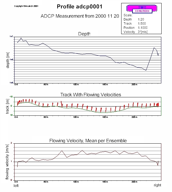
The mean of the data values under one position point (ensemble) is computed. By integrating over the profile area
the water amount is computed by HIS'3D® .
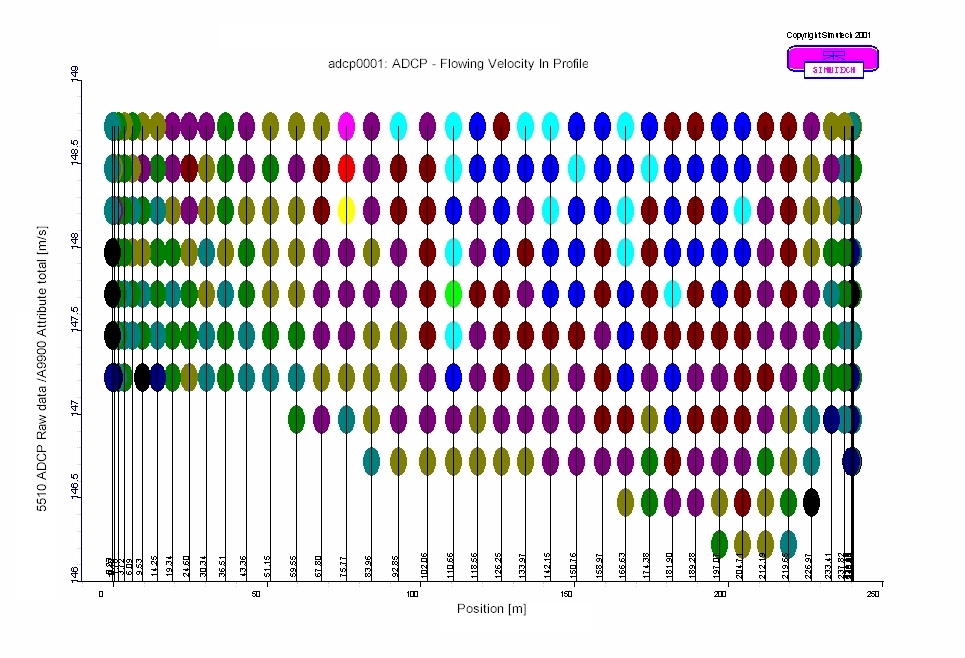
Available graphics:
All graphics are scalable and formatable (true to scale).
|
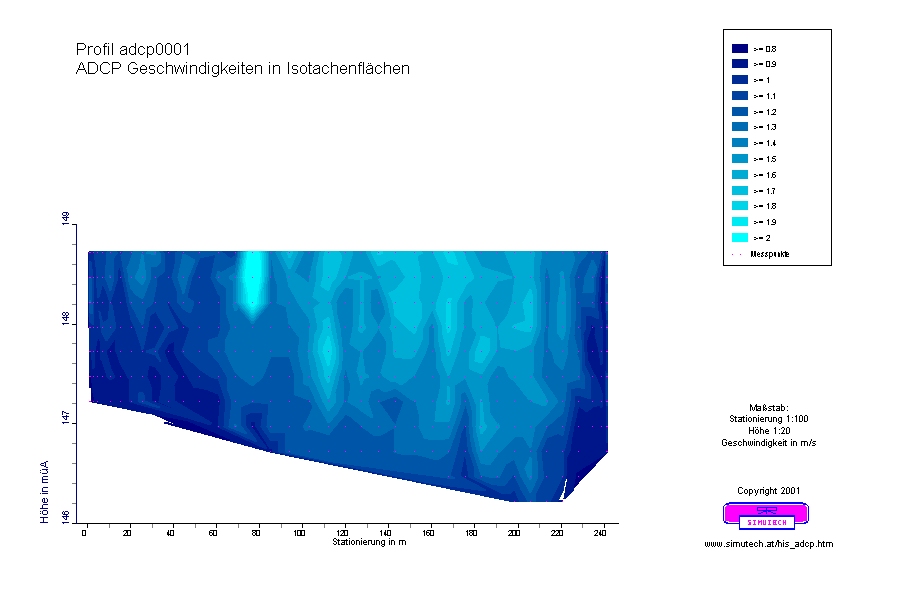
Isotachplots Together with the isoline module HISoline of HIS'3D® isotach plots in the cross section of the river or along a base point path. |
|
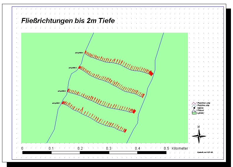
Presentations on Maps The module HISarc of HIS'3D® offers the possibility to present flowing velocities from ADCP meaurements directly on maps (e.g. under ArcView). |
|
SIMUTECH offers additional services:
Use the info-form to request further information.
| Home |
Copyright Simutech 2002
Mail to webmaster |