|
pocket eHIS
|
|
pocket eHIS offers the possibility to access environmental and geodetic data from a central HIS'3D® database in the field - e.g. using cellular connections via GSM or GPRS. pocket eHIS writeable allows for data acquisition on site. Collected data is then transmitted to the central database.
Applications and Users:
- operators, inspecting measurement stations
- negotiations and proceedings in connection with new buildings and environmental measures
You will never be angry again because of data you have forgotten in your office! - ship navigators, asking for current river ground information and water flow data being on their ship
- querying meteorological data in the field for the public (sports events, farmers)
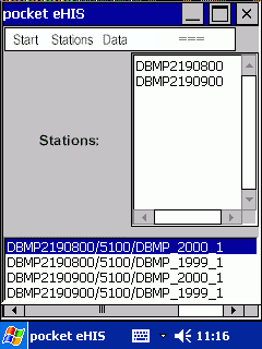 Querying a list of data (profiles, time curves), available at a group of measurement stations or positions. |
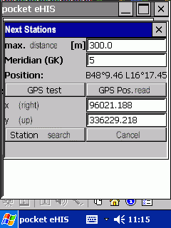 Using GPS: getting information about the nearest measurement stations. |
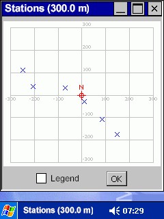 Position map of stations near to own position; information request by clicking the stations (optionally with legend). |
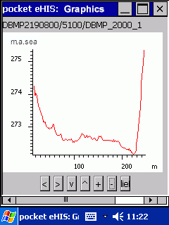 Presentation of measurement data (e.g. coordinates of a profile) as plot ... |
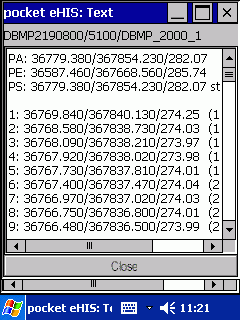 ... and text; absolute or local coordinates. |
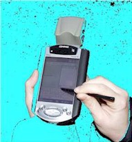
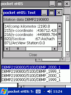 measurement station data |
Environment:
|
Technology:
|
Use the info-form to request further information.
| Home |
Copyright Simutech 2002
Mail to webmaster |